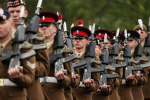
Rebecca Spayne, Managing Editor, Defence Buyer presents an overview of the different types of counter drone technology, and the growth in appetite for the proper use of drones in security, defence and police.
As technology continues to evolve and grow, we can only expect new and creative ways for criminals to gain data or access to prohibited sites, borders or crossings. This is where we have seen the adoption of drones increase over the last decade when it comes to the illegal use of the technology. This feature will first analyse the types of security and military technology available to deter and detect the unlawful use of drones, and then look at how the defence, police and private security sectors are using drones to their advantage.
Detecting drones
Drone Monitoring Equipment can be passive (simply looking or listening) or active (sending a signal out and analysing what comes back) and can perform several functions, including:
- Detection
- Classification or Identification
- Locating and Tracking
- Alerting
You should be aware that not all equipment performs all the above functionality at the same time. Detection means the technology can detect drones. Detection alone usually isn’t enough though. A radar that detects drones may also detect birds, for example.
That’s why classification is useful. Technology that classifies drones will usually be able to separate drones from other types of objects – like planes, trains, and automobiles, for example. One step further is identification. Some equipment can identify a particular model of drone, or even identify the drone’s or controller’s digital fingerprint, like a MAC address for example. This level of identification can be handy for prosecution purposes.
Being alerted that a drone is present somewhere in the vicinity is already useful. But your situational awareness, and ability to deploy countermeasures is greatly enhanced if you know the drone’s (and/or the controller’s) exact location. Some equipment will even allow you to track the drone location in real-time.
There are four main drone detection technologies:
Radio Frequency (RF) Analysers
RF Analysers consist of one or more antennas to receive radio waves and a processor to analyse the RF spectrum. They’re used to try to detect radio communication between a drone and its controller.
Some systems can identify the more common drone makes and models, and some can even identify the MAC addresses of the drone and controller (if the drone uses Wi-Fi for communication). This is especially useful for prosecution purposes – proving that a particular drone and controller were active.
Dedrone for example, states that, “almost all freely available drones use radio signals. On the one hand, they receive commands from the remote control, on the other hand they send data such as video images or telemetry, e.g. position or remaining battery power, to the remote control.”
Acoustic Sensors
Acoustic sensors are usually described as a microphone, or microphone array (lots of microphones), which detects the sound made by a drone and calculates a direction. More sets of microphone arrays can be used for rough triangulation.
Optical Sensors
Essentially optical sensors are video cameras. As well as standard daylight cameras, optical sensors can be infrared or thermal imaging.
Radar
Radar is a device that uses radio energy to detect an object. Drone detection radar sends out a signal and receives the reflection, measuring direction and distance (position).
Echodyne explains that “Drones that can be made at home for a few hundred dollars are becoming a threat. In recent years, drones have breached critical infrastructure site perimeters, interrupted airport operations, and made worrying appearances at major sporting events and large community gatherings.
“Anchoring airspace awareness with drone detection radar is a must for airports, ports, electric generation and transmission plants, water and wastewater treatment facilities, and chemical, oil and gas, and nuclear sites. Precision radar is the data-driver for accurate and timely mission control, slewing optics, sounding alarms, reducing false alarm rates, and making better decisions.
“Echodyne radar use industry-standard power and data interfaces to integrate easily into existing C2 or VMS, supporting sensor fusion. Plus, radar broadens threat detection capabilities when added to a freestanding drone detection system. The compact, solid-state form factor has no moving parts, is weather resistant at extreme temperatures, and is up and running with a single cable.”
Appetite for proper drone use
So, we have taken a look at what technology can be applied to limit and detect unlawful use of drones in different environments, but how can organisations and military uutilise the technology to our advantage? The drones we think of that may be smuggling contraband over a prison wall, is not the same type of calibre of drones that are used for law enforcement or defence.
Drones are especially useful to law enforcement and immigration authorities because they’re versatile, undetectable and relatively inexpensive, and they can link together data from multiple sources. Companies that are developing these surveillance technologies, they are quite creative in terms of mixing and matching the technologies. Some drones are equipped with license-plate readers (LPRs), which use cameras to track vehicles on city streets. An LPR-equipped drone could theoretically identify and track a single car for miles.
Mixing and matching technology in this way provides law enforcement with certain loopholes. Police need a warrant before placing a GPS tracking device on your car, for example, but not for querying an LPR database for a list of all your locations. Technology develops faster than privacy laws can keep up, especially in border communities, where law enforcement already enjoys enhanced privileges. For example, within 25 miles of the border, CBP agents theoretically operate under qualified immunity, empowering them to patrol private lands. Within 100 miles of the border, CBP agents can set up checkpoints and question, search and potentially detain travelers if they believe they have probable cause.
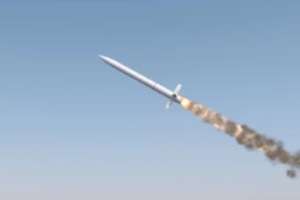
Drones range from noisy quadcopters to massive payload-carrying mini-planes. Customs and Border Protection has used military-style Predator drones to monitor the border since 2006. These US$16 million unmanned aircraft can fly as high as nine miles and are equipped with radar strong enough to detect footprints in the sand.
The Department of Homeland Security also fly smaller unmanned drones on nighttime border missions in West Texas. Called the RQ-7 Shadow and made by AAI Corporation, this type of drone is used in many different countries in addition to the US military such as the Australian army, Swedish army, Turkish air force and Italian army for reconnaissance, surveillance, target acquisition and battle damage assessment. This particular drone uses an array of cameras, lasers and radars to locate, recognise and identify targets up to 75 miles away. It then beams that information back to a ground control station.
Aside from defence and law enforcement, the popularity of drones has also grown hugely in recent years in the commercial space. In the UK, the use of drones is governed by the CAA (Civil Aviation Authority) and by law you need to register your drone with the CAA and pass a theory test to get a flyer ID before you are legally cleared to operate a drone in UK airspace. Failure to do so can result in a fine, or in the most severe cases, even a prison sentence. Any private security firm operating a drone for security purposes needs to possess both an SIA license (a legal requirement of private security professionals) and a flyer ID.
Evidence of the drone popularity in all industries is clear in the market growth reports. The marketplace that was worth US$29.8 billion in 2022 is growing 38.6% annually, and manufacturers of VTOL and UAV drones are receiving more funding to accelerate projects. An example is the recent news that Wingtra announced, where they have received US$22million series B funding to help accelerate their growth in professional mapping drones, software development for fully autonomous flights and the WingtraPilot app. These types of projects provide reliable, fast and accurate collection and processing of aerial survey data. The drones are making it easier for surveying professionals in industries like security, construction and infrastructure, mining, environmental monitoring, agriculture and urban planning and land management to digitise their surrounding world.
Maximilian Boosfeld, CEO and Co-Founder of Wingtra commented: “Our vision at Wingtra is to create a world where drones help people make the management of large parts of our planet more sustainable and efficient. We reduced the cost of adopting drone assets and increased the data quality. This will help industry to plan better and, fundamentally, improve safety for humans and the environment.
“We have built the best tool for accurate data collection and have created solutions together with our partners for a variety of use cases our customers face: As an example, our solution is used in all stages of the construction life cycle: from the concept phase (feasibility & right-of-way studies), over the design phase (bidding process, detailed design & site planning), the construction phase (progress tracking to built survey all the way to maintenance, repair and operations. And the same holds true for use cases in agriculture, land management and environmental protection. We will continue to innovate and solve the problems of the future.”
A huge advantage of drones is their agility, size, and speed. They can be deployed in a matter of minutes and reach destinations far faster than a team travelling on foot. in fact, Sussex and Surrey Police found that a drone could respond to a situation seven times faster than an officer on the ground, said a survey from Venture Security Management.
With time of the essence in an emergency, this ability to have eyes on the ground faster than ever before, offers a significant advantage when it comes to deterring criminals in the act, preventing theft and capturing images that can be used for evidentiary purposes.
In addition to being able to respond to a security breach quickly, drones also possess the unique ability to access areas that may prove problematic for vehicles or ground patrols. This presents security teams with yet another strong advantage in a time sensitive situation. Not being impacted by physical roadblocks, distances, or conditions on the ground, means a drone can respond to scenes that may be physically challenging for a ground team to navigate. This can be especially helpful in rural areas where light conditions are poor and access roads are limited.
And it is not just police that are using drones, but also private security companies. From catching a criminal in the act, to helping assess a threat to determine the risk and respond accordingly, drones offer a number of unique capabilities that can complement more traditional security measures, such as mobile patrols, CCTV, and manned guarding.
Media Contact
Editor, Defence Buyer
Tel: +44 (0) 1622 823 922
Email: editor@defencebuyer.com